Robert S. Kerr Collection
Collection
Identifier: CAC-CC-031
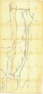
Sketch of Scenic Drive, Mena to Oklahoma, No. 103, 1960-12-24
Digital Record
Identifier: 3d44e261875d5b9edba44678aa69d6d3d
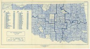
Soil Conservation Districts in Oklahoma, 1946-01-01 - 1946-12-31
Digital Record
Identifier: 942b68cf47ca869516d0c07aeca8f4f5d
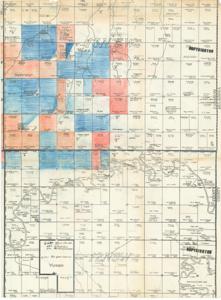
Southeast Canadian County and Northeast Grady County Plat, 1937-01-01 - 1962-12-31
Digital Record
Identifier: 86a69aa23946bc340dd6de46b1be67f5d
Speeches by Others, Charles L. Bennett, Will It Fly? A Blueprint for United Community Action, February 25, 1960
Digital item
Identifier: CAC_CC_31_10_6_76_0001
Found in:
Carl Albert Center Congressional and Political Collections
/
Robert S. Kerr Collection
/
Addition, 1896-1970
/
Speeches by Others, Charles L. Bennett, Will It Fly? A Blueprint for United Community Action, February 25, 1960
/
Speeches by Others, Charles L. Bennett, Will It Fly? A Blueprint for United Community Action, February 25, 1960
, February 25, 1960
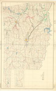
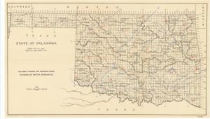
State of Oklahoma, 1952-01-01 - 1952-12-31
Digital Record
Identifier: 5fad072bf2bc83e8f729e80b83eb8886d
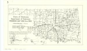
State of Oklahoma Department of Highways Progress Map 1959 thru 1962, 1961-07-01
Digital Record
Identifier: d0bafd4d0c30d91e15baac65b338b82dd
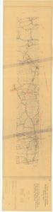
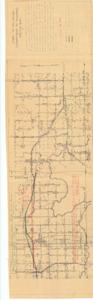
State of Oklahoma Department of Highways Route Map of S.H. 21 and Future US 59 from Broken Bow northerly by Smithville to Kiamichi Mountain in McCurtain and Le Flore Counties, 1956-02-09
Digital Record
Identifier: 5564398f21b823eef412548762dc8e1ed
Found in:
Carl Albert Center Congressional and Political Collections
/
Robert S. Kerr Collection
/
Maps, 1889-01-01 - 1962-12-31
/
O-3, 1936-01-01 - 1961-12-31
/
State of Oklahoma Department of Highways Route Map of S.H. 21 and Future US 59 from Broken Bow northerly by Smithville to Kiamichi Mountain in McCurtain and Le Flore Counties, 1956-02-09
State of Oklahoma Department of Highways Sketch Map of US 62 from Prague to Okemah in Lincoln and Okfuskee Counties, 1953-04-06
Digital Record
Identifier: 9dbfd15a80d556629638e3147781bb3cd
State of Oklahoma Department of Highways Sketch Map of US 62 from Prague to Okemah in Lincoln and Okfuskee Counties, 1953-08-28
Digital Record
Identifier: c5b6332ed9e02232fd8eb0078b3278e7d
State of Oklahoma, May 7-11, 1943 Storm, 1943-01-01 - 1943-12-31
Digital Record
Identifier: d5627007c665c03d5a894eceb28866dbd