O. P. C. Project Movement Map of Eastern United States, 1941-01-01 - 1941-12-31
Item — Box: OS 2
Identifier: CAC_CC_007_9_2_2_21
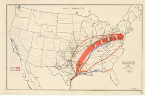
O. P. C. Project Movement Map of Eastern United States, 1941-01-01 - 1941-12-31
Scope and Contents
The O. P. C. Project Movement Map of Eastern United States is a color map labeled as Figure 2, with dimensions 16" x 10 1/2".
Dates
- Creation: 1941-01-01 - 1941-12-31
Creator
- From the Collection: Boren, Lyle Hagler, U.S. House of Representatives from Oklahoma's 4th district (1937-1947), 1909-1992 (Person)
Full Extent
1 pages
Language of Materials
From the Collection: English
Abstract
77th (1941-1943)
Repository Details
Part of the Carl Albert Center Congressional and Political Collections Repository