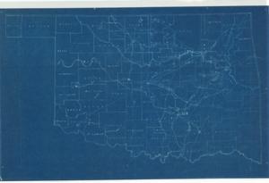
Map of Oklahoma, 1928-01-01 - 1944-12-31
Item — Box: OS 2
Identifier: CAC_CC_007_9_2_2_19
Map of Oklahoma, 1928-01-01 - 1944-12-31
Scope and Contents
The Map of Oklahoma is a blueprint that provides a detailed representation of the state's geography and features, with dimensions 20 1/2" x 13".
Dates
- Creation: 1928-01-01 - 1944-12-31
Creator
- From the Collection: Boren, Lyle Hagler, U.S. House of Representatives from Oklahoma's 4th district (1937-1947), 1909-1992 (Person)
Full Extent
1 pages
Language of Materials
From the Collection: English
Abstract
70th (1927-1929); 71st (1929-1931); 72nd (1931-1933); 73rd (1933-1935); 74th (1935-1937); 75th (1937-1939); 76th (1939-1941); 77th (1941-1943); 78th (1943-1945)
Topical
Repository Details
Part of the Carl Albert Center Congressional and Political Collections Repository