Oklahoma, Stonewall Quadrangle, 1928-01-01 - 1928-12-31
Item — Box: OS 1
Identifier: CAC_CC_007_9_2_1_9
Oklahoma, Stonewall Quadrangle, 1928-01-01 - 1928-12-31
Scope and Contents
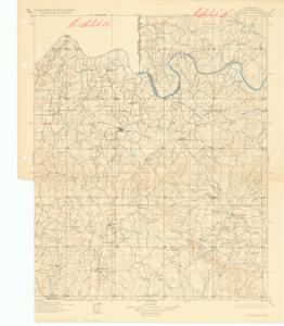
This is a topographical map of the Oklahoma, Stonewall Quadrangle, produced by the U.S. Geological Survey, Department of the Interior. Dimensions: 16" x 20".
Dates
- Creation: 1928-01-01 - 1928-12-31
Creator
- From the Collection: Boren, Lyle Hagler, U.S. House of Representatives from Oklahoma's 4th district (1937-1947), 1909-1992 (Person)
Full Extent
1 pages
Language of Materials
From the Collection: English
Abstract
70th (1927-1929)
Topical
Repository Details
Part of the Carl Albert Center Congressional and Political Collections Repository