Maud, Oklahoma, 1940-01-01 - 1940-12-31
Item — Box: OS 1
Identifier: CAC_CC_007_9_2_1_8
Maud, Oklahoma, 1940-01-01 - 1940-12-31
Scope and Contents
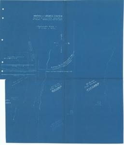
Maps of Maud, Oklahoma: This set of two blueprints depicts land, streets, water, and sewer lines for specific town sections, with one map featuring a glued photograph of a grade school. Dimensions: 22" x 17".
Dates
- Creation: 1940-01-01 - 1940-12-31
Creator
- From the Collection: Boren, Lyle Hagler, U.S. House of Representatives from Oklahoma's 4th district (1937-1947), 1909-1992 (Person)
Full Extent
1 pages
Language of Materials
From the Collection: English
Abstract
76th (1939-1941)
Topical
Repository Details
Part of the Carl Albert Center Congressional and Political Collections Repository