Lincoln, Okfuskee, Okmulgee, and Creek Counties, 1938-01-01 - 1938-12-31
Item — Box: OS 1
Identifier: CAC_CC_007_9_2_1_1
Lincoln, Okfuskee, Okmulgee, and Creek Counties, 1938-01-01 - 1938-12-31
Scope and Contents
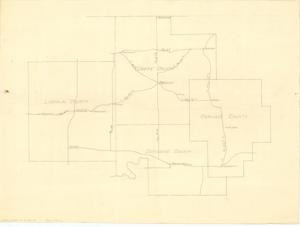
This hand-drawn map from the Bristow Chamber of Commerce covers highways and major cities in Lincoln, Okfuskee, Okmulgee, and Creek Counties. Dimensions: 18 1/2" x 13 1/8".
Dates
- Creation: 1938-01-01 - 1938-12-31
Creator
- From the Collection: Boren, Lyle Hagler, U.S. House of Representatives from Oklahoma's 4th district (1937-1947), 1909-1992 (Person)
Full Extent
1 pages
Language of Materials
From the Collection: English
Abstract
75th (1937-1939)
Repository Details
Part of the Carl Albert Center Congressional and Political Collections Repository