Official Road Map of Oklahoma, 1941-01-01 - 1941-12-31
Scope and Contents
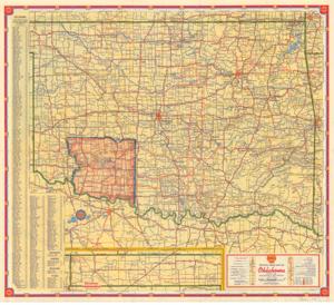
Create a concise and logical summary using the title "Road map by Shell Corporation" and the text "A portion of Western Oklahoma, including the Wichita Wildlife Refuge, is marked."
Summary: Shell Corporation's road map highlights a section of Western Oklahoma, including the Wichita Wildlife Refuge.
Dimensions: 5.3 x 4 (based on ID inference).
Dates
- Creation: 1941-01-01 - 1941-12-31
Creator
- From the Collection: Thomas, Elmer, United States Senator from Oklahoma (1927-1951); U.S. House of Representatives from Oklahoma's 6th district (1923-1927); Member of the Oklahoma Senate (1907-1920), 1876-1965 (Person)
Language of Materials
English
Conditions Governing Access
Certain series of this collection are stored off-site and require prior notice to access. If you wish to view these materials, please contact the Congressional Archives staff to arrange an appointment.
The following series are stored off-site: Constituent Services, Miscellaneous, and Office Series.
Full Extent
1 pages
Abstract
77th (1941-1943)
Repository Details
Part of the Carl Albert Center Congressional and Political Collections Repository