General Highway and Transportation Map, Jackson County, Oklahoma, 1936-01-01 - 1936-12-31
Item — Box: OS 1
Identifier: CAC_CC_053_4_0000_1_136
General Highway and Transportation Map, Jackson County, Oklahoma, 1936-01-01 - 1936-12-31
Scope and Contents
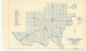
Create a concise and logical summary using the title "Transportation map by the Oklahoma State Highway Department" and the text in the summary. This map, produced by the Oklahoma State Highway Department, highlights the locations of Lebos and Gypsum Creek in red. Dimensions: not specified.
Dates
- Creation: 1936-01-01 - 1936-12-31
Creator
- From the Collection: Thomas, Elmer, United States Senator from Oklahoma (1927-1951); U.S. House of Representatives from Oklahoma's 6th district (1923-1927); Member of the Oklahoma Senate (1907-1920), 1876-1965 (Person)
Language of Materials
From the Collection:
English
Conditions Governing Access
Certain series of this collection are stored off-site and require prior notice to access. If you wish to view these materials, please contact the Congressional Archives staff to arrange an appointment.
The following series are stored off-site: Constituent Services, Miscellaneous, and Office Series.
Full Extent
1 pages
Abstract
74th (1935-1937)
Topical
Repository Details
Part of the Carl Albert Center Congressional and Political Collections Repository