Mexico, Central America, and the West Indies, 1942-01-01 - 1942-12-31
Scope and Contents
Create a concise and logical summary using the title from the TITLE column and the text in the summary.
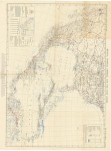
The Geographical, Hydrologic, and Transportation Map by the American Geographical Society of New York illustrates key features such as boundaries, highways, railways, rivers, airports, and townships. Dimensions: 36" x 46".
Dates
- Creation: 1942-01-01 - 1942-12-31
Creator
- From the Collection: Thomas, Elmer, United States Senator from Oklahoma (1927-1951); U.S. House of Representatives from Oklahoma's 6th district (1923-1927); Member of the Oklahoma Senate (1907-1920), 1876-1965 (Person)
Language of Materials
English
Conditions Governing Access
Certain series of this collection are stored off-site and require prior notice to access. If you wish to view these materials, please contact the Congressional Archives staff to arrange an appointment.
The following series are stored off-site: Constituent Services, Miscellaneous, and Office Series.
Full Extent
1 pages
Abstract
77th (1941-1943)
Topical
Repository Details
Part of the Carl Albert Center Congressional and Political Collections Repository