Indian Territory, 1836-1856, 1836-01-01 - 1856-12-31
Item — Box: OS 1
Identifier: CAC_CC_053_4_0000_1_34
Indian Territory, 1836-1856, 1836-01-01 - 1856-12-31
Scope and Contents
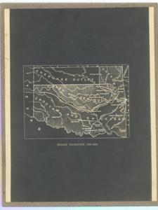
Historical map depicting the outline of Native American land and including townships. Dimensions: 10 5/8" x 8 3/8".
Dates
- Creation: 1836-01-01 - 1856-12-31
Creator
- From the Collection: Thomas, Elmer, United States Senator from Oklahoma (1927-1951); U.S. House of Representatives from Oklahoma's 6th district (1923-1927); Member of the Oklahoma Senate (1907-1920), 1876-1965 (Person)
Language of Materials
From the Collection:
English
Conditions Governing Access
Certain series of this collection are stored off-site and require prior notice to access. If you wish to view these materials, please contact the Congressional Archives staff to arrange an appointment.
The following series are stored off-site: Constituent Services, Miscellaneous, and Office Series.
Full Extent
1 pages
Abstract
24th (1835-1837); 25th (1837-1839); 26th (1839-1841); 27th (1841-1843); 28th (1843-1845); 29th (1845-1847); 30th (1847-1849); 31st (1849-1851); 32nd (1851-1853); 33rd (1853-1855); 34th (1855-1857)
Repository Details
Part of the Carl Albert Center Congressional and Political Collections Repository