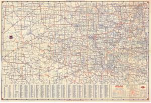
Highway Map of Oklahoma
Item — Box: OS 9
Identifier: CAC_CC_031_14_0000_9_255
Highway Map of Oklahoma, 1950-01-01 - 1950-12-31
Scope and Contents
The document represents a map highway Map of Oklahoma is part of the brochure titled "Road Map of Oklahoma and United States," which also contains "United States Mileage and Driving Time Along Main Transcontinental Highways" map. Topographic, road map (polyconic projection; gel-lithograph; color); 18 x 26 5/8 inches.
Dates
- Creation: 1937-01-01 - 1962-12-31
Creator
- From the Collection: Kerr, Robert Samuel, United States Senator from Oklahoma (1949-1963); 12th Governor of Oklahoma (1943-1947), 1896-1963 (Person)
Language of Materials
From the Collection:
English
Conditions Governing Access:
Certain series of this collection are stored off-site and require prior notice to access. If you wish to view these materials, please contact the Congressional Archives staff to arrange an appointment.
The following series are stored off-site: Clippings and Invitations.
Full Extent
1 pages
Abstract
81st (1949-1951)
Repository Details
Part of the Carl Albert Center Congressional and Political Collections Repository