Public Use Areas, Keystone Dam and Reservoir, December, 1962
Item — Box: OS 8
Identifier: CAC_CC_031_14_0000_8_242
Public Use Areas, Keystone Dam and Reservoir, 1962-12-01
Scope and Contents
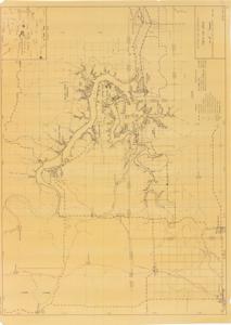
The document is a map indicating Public Use Areas, Keystone Dam and Reservoir Land use map (watershed map; sepia diazo print); 31 5/8 x 43 1/4 inches; K-107-102.4; 3.
Dates
- Creation: December, 1962
Creator
- From the Collection: Kerr, Robert Samuel, United States Senator from Oklahoma (1949-1963); 12th Governor of Oklahoma (1943-1947), 1896-1963 (Person)
Language of Materials
From the Collection:
English
Conditions Governing Access:
Certain series of this collection are stored off-site and require prior notice to access. If you wish to view these materials, please contact the Congressional Archives staff to arrange an appointment.
The following series are stored off-site: Clippings and Invitations.
Full Extent
1 pages
Abstract
87th (1961-1963)
Repository Details
Part of the Carl Albert Center Congressional and Political Collections Repository