Drainage Area Map of Kingfisher and Uncle John's Creeks in Kingfisher, Canadian, and Blaine Counties, 1948-08-01
Scope and Contents
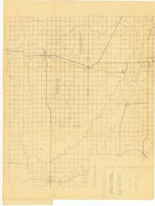
The document represents a map item is a topographic map of Kingfisher, Canadian, and Blaine Counties in Oklahoma featuring the drainage boundaries for Kingfisher and Uncle John's Creeks. Map depicts roads, highways, waterways, railways, buildings, city/town centers, and federal land. Topographic map (diazotype, blackline print); 33 x 45 1/2 inches.
Dates
- Creation: 1948-08-01
Creator
- From the Collection: Kerr, Robert Samuel, United States Senator from Oklahoma (1949-1963); 12th Governor of Oklahoma (1943-1947), 1896-1963 (Person)
Language of Materials
English
Conditions Governing Access:
Certain series of this collection are stored off-site and require prior notice to access. If you wish to view these materials, please contact the Congressional Archives staff to arrange an appointment.
The following series are stored off-site: Clippings and Invitations.
Full Extent
1 pages
Abstract
80th (1947-1949)
Topical
Repository Details
Part of the Carl Albert Center Congressional and Political Collections Repository