Denison Dam and Reservoir, Final Ownership, Sheet 13, 1957-06-03
Scope and Contents
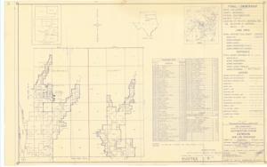
The document represents a map item is a plat of the area 22 miles northwest of Denison, Texas in Tulsa District, Southwestern Division, Marshall County, Oklahoma, which has been audited and procured for the Denison Dam and Reservoir project. The map depicts the "Final - Ownership" of the area. Plat includes a list of previous owners (vendors) and an index map. The original map print was approved on June 10, 1946, but the current map was audited January 18, 1957 and corrected June 3, 1957. Plat (map; diazotype, blueline print); 24 1/16 x 38 5/8 inches; Inscribed (bottom, right corner): Sheet: 13 of 23; Inscribed (bottom, right corner): Drawing No. SW-288/13; Annotations (lines, arrows; red, pencil) on west side of Sections 6, 7, 18, 19, 30, 31 and north side of Sections 6, 5, 4 of T7S, R5E; Inscribed (bottom, right corner; pencil): Incl 4 [?] Incl 2.
Dates
- Creation: 1957-06-03
Creator
- From the Collection: Kerr, Robert Samuel, United States Senator from Oklahoma (1949-1963); 12th Governor of Oklahoma (1943-1947), 1896-1963 (Person)
Language of Materials
English
Conditions Governing Access:
Certain series of this collection are stored off-site and require prior notice to access. If you wish to view these materials, please contact the Congressional Archives staff to arrange an appointment.
The following series are stored off-site: Clippings and Invitations.
Full Extent
1 pages
Abstract
85th (1957-1959)
Repository Details
Part of the Carl Albert Center Congressional and Political Collections Repository