Ardmore, 1952-01-01 - 1952-12-31
Scope and Contents
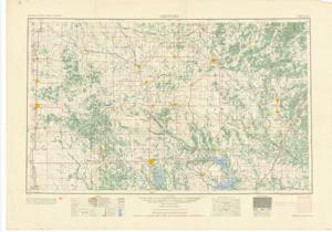
The document represents a map item is a topographic map of the "NI 14-6" section which encompasses the area N3500-W9800 to N3400-W9600. Map is a vicinity map of the areas north, east, and west of Ardmore, Oklahoma. Topographic map (transverse Mercator projection; color); 23 15/16 x 33 15/16 inches; Inscribed (top, right corner): Sheet NI 14-6; Inscribed (top, right corner): AMS Series V502; Inscribed (bottom, right corner): Printed by Army Map Service, Corps of Engineers, 9-54, 91261.
Dates
- Creation: 1952-01-01 - 1952-12-31
Creator
- From the Collection: Kerr, Robert Samuel, United States Senator from Oklahoma (1949-1963); 12th Governor of Oklahoma (1943-1947), 1896-1963 (Person)
Language of Materials
English
Conditions Governing Access:
Certain series of this collection are stored off-site and require prior notice to access. If you wish to view these materials, please contact the Congressional Archives staff to arrange an appointment.
The following series are stored off-site: Clippings and Invitations.
Full Extent
1 pages
Abstract
82nd (1951-1953)
Repository Details
Part of the Carl Albert Center Congressional and Political Collections Repository