Comparative Sailing Distances, 1945-06-12
Scope and Contents
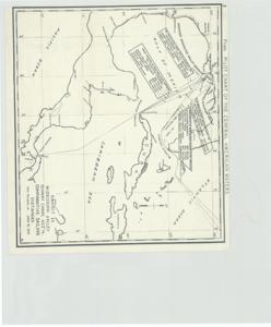
The document represents a diagram item is a map of the Gulf of Mexico and Caribbean Sea and includes Central America, Cuba, and the southern coast of the United States from Texas to Florida. Map depicts various sailing routes and their distances. "From Pilot Chart of the Central American Waters" is printed along the top of the map. Map (positive photostat print); 16 11/16 x 18 3/4 inches; Inscribed (bottom, right corner): Exhibit 11.
Dates
- Creation: 1945-06-12
Creator
- From the Collection: Kerr, Robert Samuel, United States Senator from Oklahoma (1949-1963); 12th Governor of Oklahoma (1943-1947), 1896-1963 (Person)
Language of Materials
English
Conditions Governing Access:
Certain series of this collection are stored off-site and require prior notice to access. If you wish to view these materials, please contact the Congressional Archives staff to arrange an appointment.
The following series are stored off-site: Clippings and Invitations.
Full Extent
1 pages
Abstract
79th (1945-1947)
Repository Details
Part of the Carl Albert Center Congressional and Political Collections Repository