Fort Cobb Quadrangle, Caddo County, Oklahoma, 1951
Scope and Contents
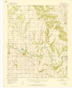
The document represents a map item is a topographic map of the Fort Cobb Quadrangle in Caddo County, Oklahoma. The map depicts the topography around Fort Cobb, Oklahoma (N3500-W9815/15) in 1951. Survey for quadrangle conducted in 1950-1951. Map features roadways, railroads, waterways, cities, towns, and natural features. Cobb Creek is emphasized with its labels underlined. Topographic map (polyconic projection; color); 21 x 17 inches; Inscribed (top, left corner): 15 Minute Series (Topographic).
Dates
- Creation: 1951
Creator
- From the Collection: Kerr, Robert Samuel, United States Senator from Oklahoma (1949-1963); 12th Governor of Oklahoma (1943-1947), 1896-1963 (Person)
Language of Materials
English
Conditions Governing Access:
Certain series of this collection are stored off-site and require prior notice to access. If you wish to view these materials, please contact the Congressional Archives staff to arrange an appointment.
The following series are stored off-site: Clippings and Invitations.
Full Extent
1 pages
Abstract
82nd (1951-1953)
Repository Details
Part of the Carl Albert Center Congressional and Political Collections Repository