Arkansas-White-Red Basins Boundary Map, July, 1950
Item — Box: OS 1
Identifier: CAC_CC_031_14_0000_1_4
Arkansas-White-Red Basins Boundary Map, 1950-07-01 - 1950-07-31
Scope and Contents
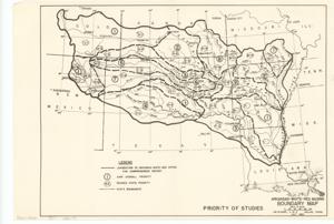
The document represents a map priority of Studies. Area plan (orthographic projection); 10 1/2 x 15 3/8 inches.
Dates
- Creation: July, 1950
Creator
- From the Collection: Kerr, Robert Samuel, United States Senator from Oklahoma (1949-1963); 12th Governor of Oklahoma (1943-1947), 1896-1963 (Person)
Language of Materials
From the Collection:
English
Conditions Governing Access:
Certain series of this collection are stored off-site and require prior notice to access. If you wish to view these materials, please contact the Congressional Archives staff to arrange an appointment.
The following series are stored off-site: Clippings and Invitations.
Full Extent
1 pages
Abstract
81st (1949-1951)
Repository Details
Part of the Carl Albert Center Congressional and Political Collections Repository