"1972 Map of McIntosh, Pittsburg, and Haskell Counties, Oklahoma with Detailed Information on Population and Infrastructure", 1972-01-01 - 1972-12-31
Scope and Contents
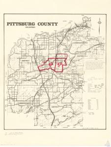
The document is a map or project documentation detailing various counties in Oklahoma, including McIntosh, Pittsburg, Haskell, and Canadian. It includes additional information such as map scale, county roads, creeks, districts, railroads, schools (with district numbers), and populations of select areas. The document also provides total road mileage for the state and county. It was drawn by David R. Marshall in March 1972 and is found in Albert. Maps. Folder 8. Item 160 of the Carl Albert Center.
Dates
- Creation: 1972-01-01 - 1972-12-31
Language of Materials
English
Conditions Governing Access:
Certain series of this collection are stored off-site and require prior notice to access. If you wish to view these materials, please contact the Congressional Archives staff to arrange an appointment.
The following series are stored off-site: Clippings, Invitations, Mail, Miscellaneous, Office, and Post Office.
Requests for Office Series: All requests must be made at the folder level and approved by an archivist prior to research. Materials must be reviewed for personally identifiable information and, if needed, appropriately redacted before the researcher is allowed to view them.
Full Extent
1 pages
Abstract
92nd (1971-1973)
Repository Details
Part of the Carl Albert Center Congressional and Political Collections Repository